Showing posts with label Shaping the Trans-Mississippi West. Show all posts

Wednesday, February 23, 2022

Four Great Surveys of the American West

After the Louisiana Purchase, the U.S. Government was interested in trying to get a basic understanding of what was in the vast new lands the country had acquired. Towards that end, the government sent out a number of surveys in the early nineteenth century. These included the Lewis & Clark expedition of 1803-1806, Zebulon Pike’s of 1806-07, and that of Stephen H. Long in 1819-20.


The Long expedition ended the official exploration of the West for about two decades, until finally in 1838, the U.S. Army established the Corps of Topographical Engineers, the purview of which included exploring and mapping the West. Among the most important of their surveys were the five expeditions led by John C. Frémont between 1842 and 1853.


After mid-century, exploration of the West picked up significantly when in 1853 Congress authorized $150,000 for the exploration of possible railroad routes across the continent, creating the Pacific Railroad Surveys to investigate possible routes across the West at four different latitudes. The results of these surveys were depicted in G.K. Warren’s important “Map of the Territory of the United States from Mississippi to the Pacific Ocean,” which summed up the government’s understanding of the West on the eve of the Civil War.


After the Civil War, the nation turned its attention even more to the American West, which was seen as an area of huge potential economic development. This led to a demand for better information on the region, a demand that was partially met by the General Land Office. The GLO was responsible for the surveying, platting and sale of public lands, so while their surveys were very important for the economic development of the West, there were large sections of the region they did not cover.


The Federal government was particularly interested in the economic resources of the West, which had not been a focus of the earlier military surveys. Thus, the government modified its surveys so that were more scientific, rather than military. These were called “geological” surveys, “geology” at the time having a wider definition than now, referring broadly to the science of the earth, including within its compass botany, soil science, archaeology and anthropology.


The first government survey dedicated to studying the geological, and thus economic aspects of a far western state was the 1860-74 California Geological Survey led by Josiah D. Whitney. This survey is important for several reasons, not the least of which was the new procedure for surveying alpine landscapes developed by its lead topographer, Charles Frederick Hoffmann.


The California Geological Survey established the methods and aims for future surveys by the U.S. Government, which in 1867 authorized the first in a series of systematic scientific surveys of the West. These became known as the “Four Great Surveys,” which ran pretty much concurrently and lasted until 1879.


King Survey (1867-73)
The first of these surveys, authorized on March 2, 1867, was the U.S. Geological Exploration of the 40th Parallel, led by Clarence King, who had worked on with the California Geological survey. The purview of the King party was to survey the lands on either side of the Pacific Railroad from California to eastern Wyoming and it was designed primarily as a practical survey to determine the economic potential of the lands along the railroad route.


The King survey resulted in the publication of a Geological and Topographical Atlas in 1876. This included a general map, then five each of topographical and geological sectional maps in sequence along the route of King’s survey. The maps were done in very large size—most sheets measure 29” x 42”—these are rare and fascinating images of the western part of the lands on either side of the 40th parallel.


Hayden Survey (1867-79)
The second of the Great Surveys began the same year as the King survey. This was led by Ferdinand V. Hayden and though it started off focused on Nebraska, within two years it became the U.S. Geological and Geographical Survey of the Territories. Hayden’s survey eventually encompassed parts of Nebraska, Wyoming, Idaho, Montana, and particularly Colorado.


Hayden issued yearly reports and these standardly include illustrations as well as maps of the different areas he surveyed. The most impressive of his cartographic publications was the 1877 Geological and Geographical Atlas of Colorado, which included four general maps of the entire state, as well as topographical and geological maps of the state broken into six sections. These provide the first comprehensive and accurate mapping of the Colorado, just a year after statehood.


Powell Survey (1870-78)
The third of the four Great Surveys was the U.S. Geographical and Geological Survey of the Rocky Mountain Region led by John Wesley Powell, a survey which lasted from 1870 to 1878. Powell had become convinced that the Colorado River canyons could be explored only by boat, so in 1869, Powell formed a private expedition and set off down the Green and Colorado Rivers. The expedition members are the first known Euro-Americans to traverse the Grand Canyon.


As the 1869 expedition ended up being more about survival than science, and as much of the data he had gathered was lost, Powell asked Congress to authorize another exploration of the Grand Canyon. This Congress did with the creation of the third of the Great Surveys, the scope of which was not only the Grand Canyon, but also the surrounding plateau lands. Powell was involved in the production of a number of maps, some of which appeared in reports from this survey, but there was no major cartographic publication which resulted.


Wheeler Survey (1872-79)
The last of the four Great Surveys was under the command of Lieutenant George Montague Wheeler. Wheeler had led surveys in eastern Nevada and Arizona in 1869. These were under the aegis of the U.S. Army’s Corps of Engineers and the surveys had primarily military objectives. By 1870, with the creation of the other three, essentially civilian surveys, the military became concerned that the job of mapping the American West was being taken away from them. Wheeler came up with the idea of having the Army survey the entire country west of the 100th meridian. The Army bought into this concept and convinced Congress that this was a good idea, so in 1872, money was appropriated to form the U.S. Geographical Survey West of the 100th Meridian.


Wheeler was never able to complete his work, though he did map a large portion of the West by the end of 1879, covering about 360,000 square miles, though that was only about on quarter of the area originally intended. Beginning in 1876, Wheeler issued a number of maps, along with a title page for a “Topographical Atlas.” The idea was that Wheeler would issue maps as the survey progressed, with the sheets eventually all gathered into this atlas. This did not happen; the intended atlas was never completed. Over the years, however, Wheeler did continue to produce maps, most sheets showing one quarter of one of his 95 quadrangles. Each year Wheeler also produced a progress map illustrating the areas that had been surveyed. Wheeler stopped surveying in 1879 but continued to issue reports and maps until 1884.


In the end Wheeler produced 71 topographical maps. Initially he was criticized for not showing enough information about the natural resources of the areas mapped, so Wheeler started to add economic or land-use maps, as well as some geological maps. Craig Haggit, of the Denver Public Library, has produced a very nice web page about the Wheeler maps, which can be seen by clicking on this link.


Competition between the surveys
It is not really surprising that right from the beginning there was competition between the Four Great Surveys, as they ran pretty much concurrently and covered overlapping areas of the West. There was a conflict between the military and civilian surveys, the military wanting to have authority over the western surveys and the scientific community wanting the same thing. There was also conflict over getting money from Congress, as there were limited funds and each survey wanted to make sure they received sufficient appropriations. Finally, there was conflict over the scope of each survey. For instance, at one point Powell tried to extend his survey to encompass the entire Rocky Mountains, but Congress demurred, saying the Rockies belong to the Hayden survey.


The most consequential of the conflicts was between Hayden and Wheeler, whose territories did overlap. This came to a head on July 9, 1873. Wheeler had sent a party, under Lieutenant W.L. Marshall, to survey south-central Colorado and at the same time Hayden had sent one of his survey parties into the South Park area, which was just where Marshall was working.


Hayden describes what happened:

“As we were riding down into the south Park, about the 9th day of July, we came across Lt. Marshall’s party and we camped together. He was a very courteous gentleman and we were very friendly. We talked matters over, and some regrets were expressed that we were on the same ground. I simply stated to him...that I had no option but to perform this work and we had had the Territory of Colorado assigned to us as a field of exploration. He simply said that he was under orders, and therefore could not disobey his orders.”
As a result, both parties set about surveying the same area in a ridiculous duplication of effort.


It was inevitable that this conflict would come to the attention of Congress. This happened when the War Department demanded an investigation in hopes of asserting its authority, through the Wheeler survey, over all the surveys of the West. As a result, the following year, the Townsend Committee on Public Lands of the House of Representatives met to consider the conflict.


One tack taken by the military was to attack Hayden personally. Marshall accused Hayden of rushing into the area specifically to preempt Wheeler (which may or may not be true). Also, supposedly, as reported by Wheeler’s geologist, Hayden was quoted as having said, “You can tell Wheeler that if he stirs a finger or attempts to interfere with me or my survey in any way I will utterly crush him—as I have enough congressional influence to do so and will bring it to bear.”


Despite these attacks, Wheeler and the military were for the most part on the defensive, as the entire scientific community backed Hayden. Wheeler’s process and maps were assailed, with Hayden’s worked stated as being much better. However, Wheeler had the backing of President Grant and in the end the Congressional committee did nothing, concluding that “there is an abundance of work for the best talents of both the War and Interior Departments in the scientific questions of the Western Territories for many years to come.” Still the committee did reprimand Hayden and Wheeler for “ill-judged and hasty expressions...which good taste would have withheld.”


The problems of having so many concurrent government surveys in much the same area persisted. The concern over this was aggravated by the rising costs of the surveys, so in the spring of 1878, the House Committee on Appropriations undertook to see if the surveys could be consolidated and condensed. At this stage, the King survey was already done, but Hayden, Powell and Wheeler were all still in the field.


In the end Congress decided that the General Land Office was to continue to survey public lands, the Coast and Geodetic Survey would continue to do “first-order triangulation of the whole country,” but a new “U.S. Geological Survey” was to “assume all surveying, mapping and geological investigations in the West.” As a result, on March 3, 1879, the U.S. Geological Survey was established, replacing the remaining three Great Surveys and beginning a new chapter in the surveying of the American West.


Monday, September 21, 2015

The origins of the Nebraska Territory

With the Louisiana Purchase of 1803, the United States essentially doubled its territory with the addition of the lands drained by the Mississippi to the west of that river. This area was mostly unknown, so the federal government tried to learn more about this new American territory by sending out a number of exploring parties, including those of Lewis & Clark in 1804-1806 and Stephen H. Long in 1820, and these expeditions did provide some understanding of the geography of the Louisiana Purchase.


One of the main reasons for acquiring the area was so the United States would eventually be able to open up an outlet for the nation on the Pacific Ocean, but also to provide new lands for emigrants from the east. Americans soon moved into the areas just to the west of the Mississippi, for instance into what would become Missouri and Iowa. By the 1820s, there was considerable settlement in the Louisiana Purchase lands near to the Mississippi River from New Orleans up to St. Louis, but beyond that there little American presence.


There was little incentive at the time for Americans to move into the western parts of the original Louisiana Territory. Reports from the western expeditions had not been glowing in their descriptions of region-—Stephen Long described the High Plains as a “desert”-—and it was already extensively occupied by Native American tribes. And on to top of this, it was far removed from the center of economic and political life in the U.S., bordered beyond by seemingly impenetrable mountains and then Spanish territory.


This made it the ideal place to help solve one of the vexing issues Americans were facing at the time, viz. what to do with the Native Americans in the East. Unlike the western tribes, those in the East occupied lands which were coveted by the Euro-Americans and in the 1820s, the federal government began a policy of moving the Eastern Indians to lands west of the Mississippi, culminating in the Indian Removal Act of 1830. This seemed a perfect solution-—to the Euro-Americans-—for they would gain lands they desired and gave up lands that were deemed essentially useless for civilized folk. An additional benefit was that this would set up a buffer between the United States and the Spanish, protecting the countries back door.


So, in 1834, an Indian Intercourse Act set aside for Native Americans "…all that part of the United States west of the Mississippi and not within the states of Missouri and Louisiana, or the territory of Arkansas…" This Indian Territory was steadily reduced over the years, but by 1845 in what had been the Louisiana Purchase, other than a single row of states and territories strung along the Mississippi River, the rest was unorganized Indian lands.


The out-of-the-way, practically useless character of this region, which made it such a perfect place to stick the Native Americans, was soon to radically change. With the increased emigration of Americans to the Oregon Country and California beginning in the 1830s, there was concern in Washington of the need for the development of the lands through which the emigrants would have to pass on their way from the Mississippi River to the Rockies. The need for a military presence for protection, a formal government structure for laws, laws for economic development, and new settlements to help feed and house the emigrants, all made it evident that there had to be some sort of governmental presence crossing the Indian Territory.


Then with the 1848 Treaty of Guadalupe Hidalgo, which ended the Mexican War, the urgency of this was made even greater. By the Mexican Cession, the United States gained another huge swath of territory, now extending the country from the Atlantic to the Pacific Ocean. The Indian Territory was now no longer at the inaccessible, back-end of the country, but was smack-dab in the middle, between “the States” and newly gained California. The Indian Territory now separated the population, money and power of the East Coast from the golden lands on the Pacific. What had been a buffer was now a barrier. Travel by sea, either around the tip of South America or by way of a land crossing at Panama, was possible, but it was quite clear that a land route across the Indian Territory-—preferably by railroad-—was something that was an economic, social and political necessity.


The need for some sort of U.S. government control over a land bridge between the territories and states along the Mississippi River and California and Oregon was clear. Between 1844 and 1854 there were 8 proposals for a new territory spanning the Indian Country. The name for this proposed territory was to be "Nebraska," a name first used by Frémont to refer to the Platte River, which was for much of its length the main route for the emigrants heading west. "Nebrathka," was an Otoe word for ‘flat water' and was used by them as the name for the Platte.


The first official proposal was by Secretary of War William Wilkins in his annual report of Nov. 30, 1844. This was taken up by Stephen Douglas with House bills in December 1844. The idea was to create a territory along the Platte River Valley with a string of military posts from the Missouri River to the Rocky Mountains. These bills failed. Another bill was put forth in 1848, and others in 1850 & 1852 & 1853, but all failed.


A number of maps in this period show these tentative Nebraska Territories. The reason none of these acts were passed was because of sectional tensions over slavery. Southerners continued to stonewall the creation of a Nebraska Territory in this region, for any such territory would, by the Missouri Compromise, have to be a free territory.


It wasn’t until Stephen Douglas’s Kansas-Nebraska Act of 1854 that a Nebraska Territory was finally created spanning the Great Plains and allowing for the building of a trans-continental railroad. The final territory was quite different than those previously proposed, for not only was it joined by another new territory to the south, Kansas, but it encompassed about half of what had been Indian Territory. By this act, the territory set aside for specifically for the Indians shrunk to just what is today’s Oklahoma (actually, the panhandle of today’s Oklahoma was not then included in the Indian Territory).


Tuesday, May 26, 2015

Poor Utah: The Black Sheep Territory

Mormons have been controversial since their founding in 1830. This was in part because of the peculiarities of their religion, in part because of the insularity of their social lives, and—perhaps as important as any of these factors—because of their practice of polygamy. Due to local conflicts, the Mormons were forced to move a number of times from places they tried to settle, culminating in 1839 in an attempt to found their Zion on the banks of the Mississippi at what became Nauvoo, Illinois.


Tensions continued, however, with those in the surrounding region harassing the Mormons and in June 1844, with a mob actually murdering the sect’s founder, Joseph Smith. Violence against persons and property continued in the following year, so that finally Brigham Young, the new leader of the Church of Jesus Christ of Latter-day Saints, decided that he would lead them west to a place where they could be practice their religion without interference, free from the prejudice and violence they had always faced.


In February 1846, the Mormons crossed the frozen Mississippi and over the next year moved slowly across Iowa, finally settling in what became known as “Winter Quarters” in the Nebraska Territory, across the Missouri River from Council Bluffs. Young’s ultimate goal, though, was further west, in the Great Basin which at the time was part of Mexico. This remote area was essentially unpopulated and was far away from any government or other settlers.


In April 1847, the Mormon’s headed west along the California Trail, arriving in July of that year. They immediately beginning to build their new community by the Great Salt Lake. In 1847, about 1,600 Mormons arrived there, followed the next year by 2,500 more, and then thousands more in the next decades.


Brigham Young wanted to create a wide spread Mormon community, sending out settlers throughout the Great Basin, and he wanted the entire Great Basin to be politically run by the Church. His plans became more difficult when, as a result of the treaty which ended the Mexican War, what had been Mexican territory because U.S. territory in 1848. In 1849, Young sent a petition to Congress to create a territory of Desert (the name derives from the word for “honeybee” in the Book of Mormon), which would have extended to all the lands lying between the Rocky and Sierra Nevada Mountains, from Oregon Territory in the north and Mexico in the south.


At that time, the citizens of the other areas acquired by the United States as part of the Mexican Cession of 1848, California and New Mexico, were applying for their admission as states, so Young soon modified his application to Congress for Desert to become a state instead of just a territory. He and the elders of the Church meanwhile drafted a state constitution and set up a provisional state government, so that they would have the wheel of power when the new state was created.


Congress definitely had an unfavorable view of the Mormons, with most Congressmen finding the religion heretical and polygamy reprehensible. This anti-Mormon feeling meant that there was no chance that Young’s proposed Desert would be realized. Instead, in 1850, Congress broke the Mexican Cession into three parts: the state of California, and the large territories of Utah and New Mexico. Utah extended from the continental divide to the Sierra Nevada Mountains, separated from New Mexico at the 37° parallel.


Interestingly, Young did not give up on his hope for a Mormon state of Deseret even after the new territorial government was set up. Young and the elders met for almost ten years in a shadow government, which ratified all the laws passed by the territorial legislature, so theirs could be created as the official government if the state were ever created. Young petitioned for the state again in 1856, 1862 and finally in 1872, but it never came to pass.


Despite this disappointment, Brigham Young and the elders did dominate the Utah territorial government and this began to lead to new tensions as non-Mormons moved into the territory. There were complaints about the theocratic rule of Utah and also about the continued practice of polygamy. This spurred the U.S. government to send troops to Utah, causing the Mormons to react as though they were being invaded.


The upshot of this was the “Utah” or “Mormon War,” which lasted from May 1857 to July 1858. There was considerable posturing and some skirmishes, with the greatest loss of life occurring when a party of California-bound emigrants were killed by a group of Mormon militiamen in what is now called the Mountain Meadows massacre. Eventually an agreement between the Mormons and the federal government led to Young giving up his governorship, though the Mormons were able to retain their operative control of the territorial government.


All of this set the scene when events began to create a need for the division of the large southwestern territories into smaller units. The Utah territory, effectively run by the Mormons, was definitely not popular with Congress, which was able to show its displeasure over the next decade. Utah and New Mexico were huge territories and as new populations moved into them, the new settlers began to demand regional divisions so they could control their own affairs with a local government. Between 1861 and 1868, Congress did create new territories out of parts of Utah and New Mexico. Not surprisingly, as Utah was apportioned, none of the divisions favored the Mormon-led government of Utah.


The division of Utah was a direct result of the movement into the region of gold and silver seekers. In 1859, a major discovery of silver—what came to be called the Comstock Lode—was found on the east side of the Sierra Nevada Mountains in far western Utah Territory. Miners poured into the area and these were definitely dissatisfied with being under the control of the Utah Territorial government. Not only was the center of the government located almost at the other end of the territory, in Salt Lake City, but these miners were for the most part strongly anti-Mormon. They soon petitioned for the creation of their own territory out of the western part of Utah.


Though many in Congress were favorable towards the notion, the creation of such a new territory was at first impossible. A new territory created out of western Utah would almost certainly prohibit slavery, both because it was north of the original Compromise of 1850 latitude line of 36°30’, but its citizens were also anti-slavery. The southern Congressmen were unwilling to allow such a new free territory and so an impasse was reached. However, when all the southern Representatives and Senators left with the beginning of the Confederacy in early 1861, the remaining Congressmen were easily able to create the territory of Nevada on March 2, 1861. This territory was created out of all that part of Utah west of the 116th meridian, about one third of the original area of the Mormon-run territory.


This, though, was not the only land which was taken from the Utah Territory in 1861. The silver rush in Nevada was paralleled on the eastern side of the Rocky Mountains when gold was discovered in 1858 near the confluence of the Platte River and Cherry Creek in far western Kansas Territory. This led to the “Pikes Peak Gold Rush” and a heavy influx of miners in such new communities as Auraria, Denver City, and Golden.


Similarly to the miners in what became Nevada Territory, the settlers along the Front Range were unhappy with what was their very distant government, located at the other end of the Kansas Territory, well to the east near the Missouri River. They also petitioned to Congress for a new territory; one group tried to create the territory of Colona and one to create the territory of Jefferson. For the same reasons that Congress was unable to act on the petition of the settlers on the east slopes of the Sierra Nevadas, it was also unable to act on the petitions of either of these Front Range groups until early 1861, when the new territory of Colorado was created.


Colorado mostly was created out of the western part of Kansas, but it also got some land from the northern part of New Mexico, the southwestern part of Nebraska, and, naturally, the eastern part of Utah. Kansas Territory had extended west as far as the continental divide and many of the initial proposals for breaking off a new territory also were limited to that western border, but when Congress did create Colorado on February 28, 1861, it was extended well west of the divide, taking up all of eastern Utah as far as the 109th meridian. Just to add insult to injury, the small northeastern triangle of Utah—between the 110th meridian and the continental divide, north of 41° latitude—was given to Nebraska Territory.


Things didn’t end here for poor Utah. In 1862, silver was discovered in the western part of the shrunk-down territory, in what would be the Reese River Mining District. Congress didn’t hesitate in deciding to move the border of Utah one more degree east, so these new mines would be in Nevada. On March 1863, the Utah western border was moved one degree further east, to the 115th meridian (note how on the bottom map above the border runs right next to the "U" in "Utah," as compared to the map above).


Just three years later, essentially the same thing happened again. Beginning in 1865, a rumor appeared concerning new mineral riches, including perhaps the legendary silver mountain, located in what was then western Utah, in an area which would become the Pahranagat Mining District. It was not known at the time whether this area was located in Nevada or Utah, so in order to be sure, in 1866 Congress once again shifted Nevada’s border one degree further east, to the 114th degree line.


Not done with their work, that same year, another chunk of the northeastern part of Utah was bitten off—the lands lying north of the 41° and east of the 111th meridian—and given to the new Territory of Wyoming.


So, from 1861 until 1866, Utah Territory lost well over half of its land through acts of Congress. It was too large to be governed practicably when first created, but much of the reduction in size had to do with Congressional bias against the Mormons. This bias is further evidenced by the fact that Nevada Territory, created in 1861, became a state only three years later in October 1864, whereas Utah Territory, created in 1850, didn’t become a state until almost half a century later, in 1896! This, naturally, happened only after polygamy was renounced in the territorial constitution that year.


Friday, May 23, 2014

Slavery and the American West


“…we tend to treat these two mid-nineteenth-century narratives as geographically distinct: a battle over slavery engulfs the East while mineral rushes and migration transform the West.” (Susan Schulten, “The Civil War and the Origins of the Colorado Territory,” Western Historical Quarterly, 44, p. 21)


As Dr. Schulten points out, contrary to the usual narrative, slavery was one of the major factors in determining the political transformation of the American West in the nineteenth century. I would argue that it was the major factor in the political development of the West, from its earliest days right through to the Civil War.


The issue of slavery was contentious between the northern and southern states from the very beginning of the nation, though many of the founding fathers hoped that slavery would slowly fade away over time. Then Eli Whitney’s 1793 invention of the cotton gin made the slave-based cotton industry profitable, as evidenced by the increase in the number of American slaves rising from 697,897 in 1790 to 1.2 million in 1810.


Louisiana Purchase


The fissure in the nation caused by slavery began to widen with the Louisiana purchase of 1803. In the early days of the republic, there was a rough parity between the slave and free states, so neither side could dominate Congress. New states would eventually be carved out of the Louisiana Purchase and the issue that worried each side was whether the new states would be free or slave.


This question was of great importance to both the North and the South. Those who wanted to abolish slavery hoped that by pinning this institution in the Southeast, it would eventually fade away. Those in the South were concerned both to maintain the vigor of the slave economy through expansion, but also to provide a new market for excess slaves they wished to sell.


The first state created from the new territory was Louisiana, a slave state, in 1812, but this simply balanced Ohio, a free state admitted in 1803. Later in the decade, new settlement and development in the territories to the east of the Mississippi River led to the admittance of four new states, Mississippi, Alabama, Indiana and Illinois, keeping the number of free and slave states equal, now with eleven in each camp.


What concerned both parties was the question of what would happen in the Missouri Territory, that is that part of the Louisiana Purchase outside of the state of Louisiana, as it was carved into new states. Slavery was legal in the Missouri Territory from the beginning, though the climate and soil of much of it was not conducive to a slave economy. The only part of the territory clearly suitable for cotton growing was along the rich bottom lands of the Mississippi River and along the lower Missouri River.


In the first two decades of the nineteenth century, Southern emigrants brought their farming economy, including slaves, up into the region around St. Louis, and west along the Missouri River, in what became known as “Little Dixie.” This was the most developed area of the Missouri Territory, with St. Louis—-a major center for trade and commerce-—growing into a city of over 10,000 citizens by the end of the second decade of the nineteenth century. In 1818, the citizens around St. Louis petitioned Congress for admission as a new, slave state of Missouri.


The Northerners in Congress were unwilling to allow such a new slave state. It was more than simply the fact that this would upset the balance of free and slave states. Louisiana had long had a slave economy, but the idea of opening up the lands further north to slavery threatened the long-held belief that the institution could be limited to the South, eventually to fade away. Northerners were adamant in trying to prevent this.


Missouri Compromise


A compromise, brokered by Henry Clay and John C. Calhoun, was reached in 1820 which was acceptable to both Southerners and Northerners. As part of this “Missouri Compromise,” the District of Maine, a detached part of Massachusetts, would be admitted as a state along with Missouri. Maine had been clamoring to become be admitted to the Union on its own and since it would be a free state, it would off-set Missouri as a slave state, with the balance in Congress maintained.


Still, however, Northerners were adamant against the expansion of slavery into the lands in the northern part of the Missouri Territory, so as part of the compromise it was agreed that no new slave states—-other than the new state of Missouri—-could be carved out of the original Louisiana Purchase north of the 36°30′ parallel—the line which separated Virginia from North Carolina, Kentucky from Tennessee, and Arkansas from Missouri.


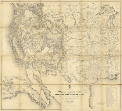
In hind-sight, Southerners realized that the Missouri Compromise had placed pro-slavery forces at a great disadvantage. A look at the map of the United States showed that the area open for free states was far larger than that from which slave could be created, consisting only of the Arkansas Territory. A look at the larger map of North America, however, showed a lot of land west of the Mississippi and south of the 36°30′ line, land, though, which inconveniently was part of a foreign country, Mexico.


Compromise of 1850


About this time Americans began to move into Texas, the province of Mexico bordering Louisiana and Arkansas. While slavery was outlawed in Mexico in 1829, the new Texans ignored this prohibition. The American pro-slavery faction could not help but covet Texas-—almost half the size of the Louisiana Purchase—-already inhabited with slave owning American emigrants, especially when it declared itself an independent republic in 1836.


Texans themselves were strongly in favor of being annexed into the United States, and pro-slavery American politicians dreamed of adding Texas to the Union as a single or perhaps even multiple slave states. Their plans took on added urgency when Britain decided it would recognize Texan independence and push for the abolition of slavery there. The desire by Southerners to add Texas to the Union led finally, in 1845, to the annexation of Texas as the 28th state. As U.S. Grant wrote, “The occupation, separation and annexation were…a conspiracy, to acquire territory out of which slave states might be formed for the American Union.”


Prompted in part by a desire for even more land which would be open for slavery, the United States provoked Mexico into the short-lived Mexican War. At the end of the war, by the 1848 Treaty of Guadalupe Hidalgo, Mexico, in return for a payment of just over $18 million, not only recognized Texas as part of the United States, but ceded their provinces of Alta (or Upper) California and New Mexico.


The acquisition of these new lands to the west of the original Louisiana Purchase immediately raised the issue of how they were to be politically organized and, of course, what role slavery would play there. During the war, Congressman David Wilmot had introduced a bill to prohibit slavery in any territory captured from Mexico. Naturally, this bill was fought against by Southerners and though it passed the House, it failed in the Senate.


How the new lands of the Mexican Cession were to be governed was an issued which had to be faced by Congress, but this was quite a complex issue. The old Mexican settlements of California saw themselves as forming a mature political entity ready for admission as a state, and the Mormons were proposing a new state of Desert to be formed from the lands south of the Oregon Territory lying between the Continental Divide and California. Most Congressmen agreed that the Mormons could not have their desired state, but there was disagreement on almost all other questions of what to do with these new American lands.


One sore point for Northerners was that Texas, which allowed slavery, extended above the 36°30′ line—-when it first was annexed, Texas claimed as far north as present-day Wyoming-—which they argued was contrary to the Missouri Compromise. Northerners were thus determined that there would be no slavery allowed in the new territories acquired from Mexico. Southerners felt like the Northerners were running roughshod over the previous balance of power between the two sides by wanting to admit a new free state of California while at the same time excluding slavery from the rest of the Mexican Cession.


The solution to this conundrum was devised by Henry Clay and Stephen Douglas, who pushed through what is known as the Compromise of 1850. This was based on Douglas’ avocation of the use of the principal of “popular sovereignty” to get around the slavery question in the new territories. By that policy, citizens of the new territories would be able to decide for themselves whether their new states would be free or slave, writing this into the state constitutions as determined by democratic vote. Thus, when the territories were admitted as states, they would “be received into the Union, with or without slavery as their constitution may prescribe at the time of their admission.”


By the Missouri Compromise, the North got a new free-soil state, California, and had the northern border of Texas cut off at 36°30′ (in exchange for $10 million of debt relief), while the South got the possibility of slavery being voted in for the two new territories created between Texas and California—Utah and New Mexico—and they also got a stronger Fugitive Slave Act.


Many Northern Congressmen found this an unsatisfactory agreement, both because of the Fugitive Slave Act, but also because the possibility of slavery in the new territories, both of which had lands above 36°30′, seemingly a repudiation of the Missouri Compromise. Douglas, however, argued that the Missouri Compromise applied only to the lands of the original Louisiana Purchase, not to the Mexican Cession, and assuring fellow Northerners that the Missouri Compromise would continue in force there. He further sweetened the deal by including a clause into the new compromise for the abolition of slave trading in the District of Columbia.


The Compromise of 1850 did finally allow for the political organization of the lands gained in the Mexican War, and it was hailed by some as solution to how to keep the South and North from falling out over the issue of slavery. That was a premature and false hope, for the possibility that slavery might be allowed north of the 36°30′ line, together with the strong Slave Fugitive Act, lit a smoldering fuse of passion in the North, a fuse which would burst into flame just a few years later, sparked by another Congressional act shepherded through by Stephen Douglas.


Kansas-Nebraska Act


Within a few decades of the Louisiana Purchase, inspired in part by Stephen Long’s description of much of the lands west of the Mississippi River as the “Great American Desert,” the Federal Government decided that this area would make a perfect place to locate not only the western Indian Tribes, but also those from the East whose land was confiscated. The Indian Intercourse Act of 1834 set aside for Indian territory "…all that part of the United States west of the Mississippi and not within the states of Missouri and Louisiana, or the territory of Arkansas…"


This region comprised most of the Great Plains lying between the Rocky Mountains and those states and territories just to the west of the Mississippi River. As Americans began to move towards the west coast, it soon became evident that there was the need for the extension of U.S. law, especially related to property, to that part of the Indian lands through which emigrants traveled and where a railroad could be built.


For this to happen, at least a band of land crossing the plains had to be organized as a U.S. territory. The designation of this proposed territory was to be "Nebraska," a name first used by Frémont with reference to the Platte River, which was for much of its length the main route for the emigrants heading west. "Nebrathka" was an Otoe word for ‘flat water' and was used by them as the name for the Platte. A bill to create a Nebraska Territory was first introduced in 1844, with another put forth in 1848; both bills failed because this territory would be north of the Missouri Compromise line and Southerners were loath to create such a large, free-soil territory.


With the acquisition of California in 1850, the need to organize such a territory became even more urgent. For both economic and social reasons the country needed to connect the East and West Coasts with a railroad. Thus pressure to organize these lands continued to grow.


Stephen Douglas turned from his “triumph” in the Compromise of 1850 to tackle this problem, which he again “solved” using his principal of popular sovereignty. Douglas proposed that two new territories, Kansas and Nebraska, be created under “popular sovereignty,” each able to determine for itself whether it was slave or free.


This was acceptable to many Northerners, especially those who were keen to have a trans-continental railroad built, for they believed these two proposed territories were situated too far north to prove hospitable to slavery. Ironically, many Southerners accepted this compromise because they thought that at least the Kansas Territory would be favorable to the introduction of slavery, as it lay directly west of the slave state Missouri.


In order to make sure Kansas voted to come in as a slave state, Southerners were encouraged to move into Kansas, while abolitionists in the North did the same thing, promoting antislavery settlements there. Thousands poured into the new Kansas Territory, armed and ready for a fight over slavery. “Bloody Kansas” was the immediate effect, but another more lasting consequence was that many antislavery proponents in the north—both Democrats and Whigs—left those parties to form a new Republican Party, specifically organized to prevent the expansion of slavery into the new territories.


New Territories


In the years leading up to the Civil War, an increasing movement to create new territories ran smack into a Congressional blockage caused by the hardening sectional conflict between the supporters and abhorrers of slavery.


New emigrants were pouring into the large territories of the West, many prompted by gold discoveries, and this generated strong pressure to create smaller territories for these populations. Many of these new settlements were located well away from the centers of power in the old territories and the emigrants wanted to have local control. The New York Times reported on Jan. 11, 1859 that there were six applications for new territories before Congress, five for trans-Mississippi regions.


Despite these, and other petitions for territorial creation, Congress would not act. With a roughly equal balance between the free and slave states, neither side was willing to let in a territory or state which would lead to one side gaining a significant advantage in Congress. No new territory was created between the Kansas-Nebraska Act and 1860.


This all changed in early 1861 when eleven state seceded from the Union, with all their Senators and Representatives leaving Congress. All of a sudden, Congress was heavily weighted towards the north and mostly anti-slavery. Within just the first three months of 1861, three new territories-—Dakota, Nevada and Colorado—-were created, all free-soil.


The final political alteration in the American West that was specifically related to the issue of slavery was the creation of the Territory of Arizona in 1863. About a decade before, in 1854, the Gadsden Purchase added about 30,000 square miles to the southern part of the New Mexico Territory. This area was called either “Gadsdonia” or “Arizona.” The settlers who moved into this area felt alienated and neglected by the territorial government in Santa Fe, located well to the north. These settlers, most of whom were originally from the South, were not particularly keen to be administered by a government which had a large Hispanic element to it and which was anti-slavery.


Thus, in 1856 and then again in 1860, conventions were held to create a Territory of Arizona from the lands south of the 34th parallel. The Arizonians elected a territorial governor and sent a delegation to Congress asking for the establishment of this territory, but as with the other similar requests of the time, Congress did not act.
The Arizonians were not happy, so when the Confederacy was created in 1861, they voted to secede from the United States and join the Confederacy, which accepted Arizona as a territory in early 1862. A year later, Congress—-now free to create free-soil territories-—did decide to create an Arizona Territory, but with a north-south border, rather than east-west, for this both avoided a de facto recognition of the Confederate Territory and it diminished the influence of the southerners in the new territory.


From this brief history, it is clear that slavery played a preeminent role in almost all the changes to borders, territories and states in the trans-Mississippi West from 1803 through the Civil War. Other factors, of course, did play significant roles, but the issue of slavery was always there, greatly determining outcomes. It was certainly in the eastern U.S. that slavery drove the hammer of conflict most strikingly, but the West too was greatly shaped by the chisel of the fight against bondage.


Tuesday, April 8, 2014

Splitting Dakota Territory

New research at the Philadelphia Print Shop often results from our acquiring a new print or map which contains an interesting feature about which we do not know much. This happened recently when we were writing up a map of the United States from 1882 by John Bartholomew. Looking over the map, we noticed that the Dakota Territory was divided, even though this map was issued four years before North and South Dakota were created. A closer look showed that the northern section was titled "Lincoln" and not North Dakota.


Vince Szilagyi decided to figure out what this was about and he found that this "Lincoln Territory" was just one of several proposals for the division of the Dakota Territory before 1886. Here is what he found out:


Initially, a huge Dakota Territory was created out of parts of the Nebraska and Minnesota Territories in 1861, extending from Minnesota to the Continental Divide and between the 43rd parallel and the Canadian border. This vast territory was whittled down in the next few years so that by 1868 the territory essentially encompassed the lands lying today within North and South Dakota. Prior to the Civil War, most of the population consisted of Native Americans, primarily Sioux, settled on several Indian reservations.


After the end of the Civil War, the Dakota Territory had become a place of major activity and interest for Euro-Americans in a United States eager to expand and grow after years of destruction. The territory experienced an explosion of development in the 1870s due to its mineral wealth, fertile soil and the expansion of the railroads into the region. As the area boomed and the Indians were displaced by a series of conflicts with the US Federal Government, there began a series of calls to split the huge territory into smaller, more manageable units.


The desire to break the Dakota Territory into smaller units was prompted by a couple of factors. First, the territory had two main population centers, one in the northeast around Bismark and one in the southeast around Yankon. These were separated by hundreds of miles of difficult and untamed terrain. The isolation was so pronounced that Judge J.A. Barnes of the Dakota Territory Supreme Court proclaimed “The people of Northern Dakota want a division of the territory because they are so far remote from Southern Dakota that they do not feel any identity of interest.”


Secondly, and perhaps more importantly, dividing the territory into two parts would double the number of Senators sent to Washington from the Dakotas when they eventually became states. As the territory at the time was solidly Republican and the Senate was tightly contested, the Republican Party supported the split wholeheartedly. Surprisingly enough, the Democrats also believed splitting the territory would be to their advantage, as they had hopes that one of the new territories would swing Republican and the other Democratic.


Despite, or perhaps because of these factors, the actual splitting of the territory was a difficult and slow process. Numerous proposals were put forth and bills submitted to split the Dakota Territory into smaller units during the 1870s and ‘80s. None of these succeeded until 1889, when the division was finally realized, with the admission of two new states, named sensibly, albeit somewhat dully, North and South Dakota.


The earlier proposals were unsuccessful for various reasons and their proposed political entitles, with names such as Pembina, Huron and Lincoln, were never realized in fact. However, they did, get a ghostly, cartographic existence, appearing on a few maps, now of considerable interest to collectors and students of history.


Pembina

An early proposal to split the Dakota Territory involved chopping off essentially the top half and naming it Pembina. Pembina Territory never became a reality, although in the Dec. 22nd, 1874 edition of the Sacramento Daily Union there is a brief one sentence note declaring that "The Pembina Territory Bill was revived on motion of Boreman" in the U.S. Senate, indicating that the idea was at least discussed beyond the wilds of the Dakota Territory. Only one cartographer, John Bartholomew of Philadelphia, seems to have put the proposed territory on his maps, making these particularly rare.

Huron

Another similar proposal to split the territory was made in July of 1876. A convention was held in Yankon (the territorial capital and now in South Dakota) to address the question, where the Dakotans came to the conclusion that they supported “the organization of a new territory out of the northern part of Dakota, and believe such an organization will largely tend to enhance the interests of the people in both sections." The U.S. Senate passed a bill in December of 1876 to create the Territory of Huron out of the Dakota Territory north of the 46th parallel. The bill was never signed into law, but some cartographers took a gamble and included the nonexistent territory their maps. This “jumping the gun” by publishers was not unusual, as fierce competition often spurred the companies to try and be the first to show new developments.

Lincoln


During the 1880’s, several further attempts were made to split off the northern portion of Dakota into a Lincoln Territory. Unlike Huron and Pembina which more or less shared their borders with present day North Dakota, the Lincoln Territory would have encompassed all of present day North Dakota as well as extending into modern day South Dakota. This larger territory was bitterly opposed by Democrats in the territory as well as Democrats in the Senate, who refused to consider a bill creating a territory named after their most bitter political foe. Thus this bill never made it past the Senate.